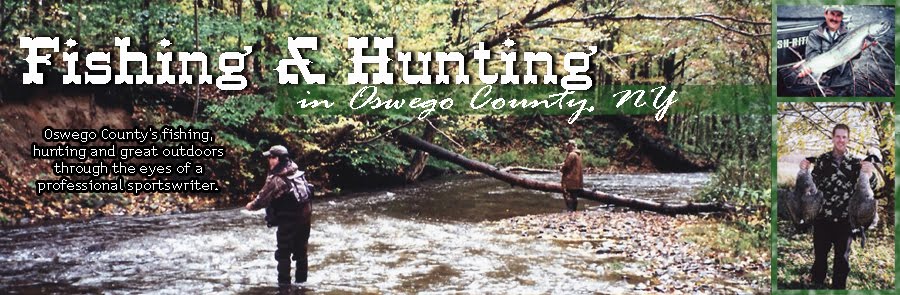
Showing posts with label deer creek marsh. Show all posts

Wednesday, June 26, 2013

Deer Creek Marsh Wildlife Management Area

By
Spider Rybaak

Canoeing the pond, Deer Creek WMA.


Oswego County is blessed with some of the largest, most awesome wildlife management areas in New York.  None, however, comes close to offering the wide variety of recreational opportunities, steeped in natural beauty, Deer Creek WMA provides.

One of three WMAs punctuating the Eastern Lake Ontario Dune and Wetland Area, a 17-mile-long barrier system boasting the tallest sand dunes between Cape Cod and Lake Michigan, Deer Creek WMA sprawls over 1,771 acres. Tucked between the mouth of the Salmon River and Sandy Pond, two heavily developed areas famed for their splendid beaches and sunsets, it’s like a breath of wilderness among the cottages; and it’s all close to the road.

Its most popular feature this time of year is a mile-long cobblestone beach. It used to be sandy, but the jetty that keeps the mouth of the Salmon River from wandering blocks currents from sweeping sand off a submerged dune out in the lake and bringing it close to the beach where it's picked up by waves and deposited  on shore.  

Without this continuous supply of sand to replenish what the waves wash away during high water, all that’s left on the beach when the water goes down is cobbles.

Fortunately, the order of this natural masterpiece prevented man’s folly from turning its undulating habitats into a level wasteland. You see, a dune and wetland area is comprised of six zones stretching from the water to the upland forest marking the end of the barrier system: the beach, fore dune, trough, secondary dune, back dune and wetland. Like the front in a battle, the fore dune is the system’s first line of defense, protecting its interior from the worst Lake Ontario dishes out. Luckily, it did its job long enough for environmentalists to see the sand slipping through the stones  and take measures to prevent further erosion.

A saddle-like trough separates the fore dune from the back dune. A trail, cut over the years by hikers, slices through its patchwork of beach grass and poison ivy. 

Beyond the trough, the secondary dune begins its steep ascent, climbing up to 40 feet in spots. Clumps of beech grass cling to its sandy sides all the way to the crown cropped in mature cottonwood s. On the other side, the back dune descends into a pond created by Deer Creek on its last leg to its mouth. By this point it moves so slow, it seeps into the sand before reaching the lake.

The stream’s water temperature keeps the system cool enough to support thriving populations of fish, including largemouth bass (some over 6 pounds), northern pike (most are axe handles, but some go 30 inches) bullheads up to a foot long, and yellow perch and sunfish averaging 6 inches. It even harbors bowfin; a native species that’s been around since the Jurassic period and can breathe air.

Canada Geese, mallards, blue herons, kingfisher, osprey, and a variety of less common water fowl; and mammals like mink, muskrats and beaver find Deer Creek Marsh to their liking.  Pheasants and cottontail rabbits flourish in the WMA’s grasslands. Whitetail deer, raccoons and turkeys flourish in the woods tracing its edges.

Most argue the best way to see the marsh is by canoe.  “You can silently paddle up to everything from beavers to geese,” argues cousin Staash.

The access site on NY 3, 2 miles north of Port Ontario, offers parking for about 10 cars and a beach launch.

Others prefer to hike it’s two most prominent features, the beach and sand dune. Although climbing and walking on dunes is prohibited, the trough between the fore dune and secondary dune has a ½-mile long trail running through it, and a couple of boardwalks allowing folks to cross over the fore dune without hurting it or brushing the poison ivy that grows on it like a weed. The southern boardwalk ends in a fishing platform looming over the pond.

Get there by heading north on NY 3 from Port Ontario for a little over 2 miles. Turn left on Rainbow Shores Road, drive to the end, turn left on South Rainbow Shores Road (unmarked), bear left at the fork a few hundred feet later and continue to the parking lot.

WMAs are managed…you guessed it, for wildlife and related recreation: primarily hunting, fishing , bird watching, stuff like that. 

Off-road vehicles, camping, and camp fires are prohibited.

Boardwalk.

Walking the Trough.

Gateway to the beach.

Friday, September 28, 2012

Pheasant Season Just Around the Corner

By Spider Rybaak


For most outdoor lovers, October in Oswego County promises streams swollen with trophy salmon and trout, Oneida Lake walleyes moving to within casting distance of shore, and the discordant songs of waterfowl streaming through the air above it all. But water sports ain’t all the county has to offer. Indeed, when the waters meet dry land—and they always do, eventually--new habitats are created, ideal stomping grounds for birds of a different feather: pheasants.

Pheasants hail from Asia. And although they’ve made a solid foothold in America, primarily the Midwest, the species doesn’t do too well in northern NY because our predators, everything from skunks to foxes, feed on their eggs and young.  And while some chicks survive and even propagate, their numbers are few and getting a home grown ring-necked pheasant is extremely challenging.

But Oswego is loaded with edge habitats mature birds find to their liking: farmer’s fields, hedgerows, woodland undergrowth, and brushy clearings around wetlands. So the New York State Department of Environmental Conservation raises thousands of birds each year and releases them into the wild when they reach adulthood.

This year the NYSDEC will release 30,000 birds just before the season opener: October 1, in Oswego County. What’s more, the agency will unloose the county’s share just before the special youth hunting weekend, September 29-30, 2012.

To qualify for the special season, a child must be between 12 and 15 years old, possess a current hunting license, and be accompanied by a parent or adult guardian while hunting. The elder is required for supervision only and isn’t permitted to do any actual hunting (see page 34-35 in the “New York Hunting and Trapping Guide for further information).

The lion’s share of the ring-necks destined for Oswego County is going to be released in two publicly owned parcels: Deer Creek Marsh Wildlife Management Area and Three-Mile Bay WMA.

Three Mile Bay WMA is south of NY 49 in West Monroe and is easily accessible off Toad Harbor Road, McCloud Drive and West Road.

Deer Creek Marsh WMA is a couple miles north of Port Ontario, on the west side of NY 3.

Pheasant in flight near Deer Creek WMA

Deer Creek Marsh WMA pheasant habitat as seen from the Rainbow Shores Drive public access site, about 1/4 mile west of NY 3.
Salmon River Update:

This month marks the lowest the Salmon River has been in September in recent memory. Still, kings have been storming upstream in strength for the past week.


Stringers loaded with kings. 

Tuesday, August 17, 2010

Flyway of the Monarchs

Oswego County is full of natural wonders. Spectacular geological features like the Salmon River Falls Unique Area and the fabulous sand dunes at Deer Creek Marsh Wildlife Management Area etch the landscape. World class salmon, steelhead and walleye swim in our waters. And each spring and fall our friendly skies load up with migrating fowl of every feather.


But not all miracles are big and obvious. Indeed, Oswego County is full of marvels of a smaller nature, and one of the most colorful is the fall migration of monarchs.


The majestic monarch travels thousands of miles in its life journey. (Photo by NYS DEC Web site).


This majestic butterfly’s range reaches way into Canada. As summer days grow shorter, signaling the butterflies to start moving to warmer climates, those born north of the border leisurely head south. Reaching Lake Ontario, they’re reluctant to fly over the huge pond. Although they can flutter for long distances, they have to stop sometime, to get out of heavy winds, to rest, roost, stuff like that. So they try to fly over land as much as possible and skirt the shoreline looking for some they can follow to the U.S. of A. At Cape Vincent they bank a sharp right.


Just about any refuge will do in an emergency. However, given a choice, monarchs prefer certain spots. In fact, they have an uncanny knack for resting in places their ancestors also frequented, often in the same tree their great grandparents used (four generations are produced each year) when they made the trip last fall.


Two of their most popular Oswego County haunts are Deer Creek Marsh Wildlife Management Area and Sandy Pond. The back sides of the dunes offer great protection from the weather, and lots of trees and bushes for perches.


They start migrating in good numbers in mid-August and continue coming until about mid-September. When they finally settle down for the night, they can fill a bush so thick, its branches seem to sprout quivering blotches of orange and gold.


I went up to both spots last week to see what I could see. I wasn’t disappointed. As I walked the beach, I looked north and my eyes settled on the graceful dance of several individuals.


When you first catch sight of one, it’s a fleck in the distance, so small and insignificant you think it’s a floater (one of the tiny spots some of us have in our vision). As it gets closer, you notice its telltale swaying flight and before you know it, a full blown monarch is effortlessly floating past you. It’s humbling to see how such a delicate, weightless critter can remain on its flight path pitted against such a vast expanse of open air and water.


I didn’t see flocks, but I did see several, including a small cluster resting on a tree trunk.


They should start appearing in massive quantities in late afternoon from now until the middle of next month. The best way to locate a batch is to walk the beach and keep an eye out for specks on the horizon that are flying in a determined direction, but in a very roundabout way. If your timing is right, they’ll lead you to their roost.


If luck is with you, you’ll find a tree pasted with tiny, colorful sails gently flapping in the breeze, and others circling the branches looking for perches. You’ll walk away with the knowledge you witnessed one of life’s smallest, most colorful miracles unfold before your eyes.

(The following photos were taken by Janet Clerkin)

A DEC interpretive sign at the parking area at Deer Creek Marsh explains how the dunes were formed. To reach this parking area, turn left at the end of Rainbow Shores Road in the Town of Sandy Creek.


Monarchs cross over miles of open water before landing on the beach.


The shoreline at Deer Creek Marsh, looking north. The area is owned by the NYS DEC and is part of the unique Eastern Lake Ontario freshwater dune system.


Driftwood on the beach.


Shrubs, small trees and dune grass line the edge of the beach at Deer Creek Marsh and provide a place for the monarchs to rest.


The back sides of the dunes offer shelter from the weather.


A viewing platform is situated between the marsh and the shoreline, offering an expansive view of two distinct habitats.


Milkweed and Queen Anne's Lace are common in the upland areas of the dune system.


Goldenrod is a bright symbol of late summer.


Fields of Queen Anne's Lace thrive along the back side of the dunes at Deer Creek Marsh. The dainty flower originated in Europe and is a member of the wild carrot family.


The milkweed plant plays an important role in the life cycle of the monarch. The butterfly lays its eggs on the leaves, the caterpillar feeds on the leaves, and the butterfly feeds on the milky white liquid during the late summer.


Matilda enjoys the late afternoon breeze off Lake Ontario.