Showing posts with label port ontario. Show all posts

Wednesday, September 14, 2016

Estuary Perch

Stan Oulette of Deer Creek Motel; Pulaski, N.Y.


Back in the early 1960s, catching Pacific salmon and steelhead in Lake Ontario was just a dream entertained by fish and game officials and dreamy-eyed anglers, many of whom had fished out West.

To your average local angler, the targets of choice were warm-water species like smallmouth bass, northern pike and yellow perch. The estuary, the slow-moving, lower stretch of the Salmon River running from the last set of rapids to the mouth, was one of the best spots around to catch ‘em all, especially a bucket of yellow perch.

“Still is” boasts Stan Oulette of Deer Creek Motel, located on State Route 3, a couple miles north of Port Ontario. “In fact,” he claims, "it’s Oswego County’s best kept secret.”

Stan and his brother David are local experts on the lower river. With good reason: both, along with their families, love to eat fish, and perch are their favorite. 

“The estuary always holds fish,” claims Stan, “but they change with the seasons… northern pike are plentiful in the spring, bass are in all summer long, salmon and brown trout come through in the fall, steelhead in winter and spring, and perch…ahh, perch,” he goes on, dreamlike  “… they’re always around.”

The bait of choice for these tasty panfish is a minnow fished on bottom or suspended a few inches off the floor below a bobber. Squeamish anglers and those who prefer artificial lures will catch a batch by jigging a Berkley Atomic Teaser tipped with a Power Honey Worm.

An angler inexperienced in the ways of Lake Ontario tributaries would probably conclude the perch—indeed, all panfish—flee the estuary at the first sight of a salmon.

The exact opposite is true; panfish are drawn into the estuary and spurred into a feeding frenzy by all the salmon eggs and tiny life forms that feed on salmon cadavers.


Monday, March 10, 2014

Dipping for Smelt


By Spider Rybaak

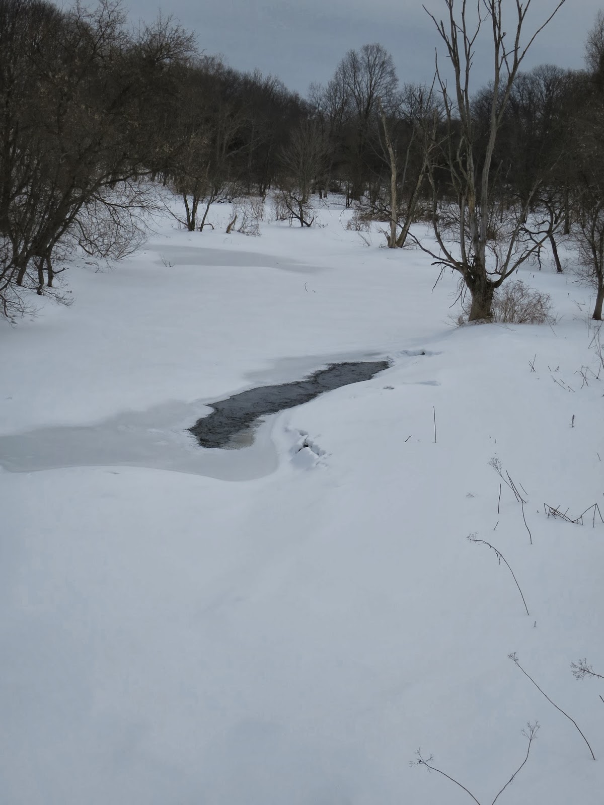
 Grindstone Creek from the NYS Rte. 3 bridge, March 5; gotta wait until ice-out to dip.

Back in the early 1960s, environmental pollution was rampant. Lake Erie was so dirty, authorities began drafting a death certificate. Lake Ontario was much deeper so it could swallow more stuff, but it was limping along on its last leg, too; fish populations were down to a fraction of what they used to be.

But there was hope.

By the middle of the decade, strict environmental laws were passed and enforced. Nature responded quickly, improving the water in the Lower Great Lakes to such a degree that fish numbers took off. Since it takes a while for game fish to grow to legal size, they were slow in coming around; but bait fish populations exploded.

That was good…and bad.

First the good: smelt reached such incredible numbers, guys dipping for them in the mouth of the Salmon River could fill 5-gallon buckets with their eyes closed. On skinny creeks like Deer and Little Sandy, conscientious anglers dipped gently, carefully to avoid crushing the smelt below the net’s rim or hurting those off to the sides.

The bad: alewives thrived, too. Boney and tasting like swamp mud, they were avoided by man. Unsightly winter kill lined beaches around the lake and the authorities decided to bring the lake back into balance by stocking voracious lake trout, king and coho salmon.

It worked. The salmonids swam around with mouths wide open, growing huge. Smelt numbers dropped incredibly. Dave Wood, owner of Woody’s Tackle on NYS Rte. 3, says dipping for them got so bad by the late 70s, he stopped going.

Fran Daher, over at North Syracuse’s Mickey’s Live Bait and Tackle concurs. “We used to sell dozens of dipping nets annually in the 70s, now we’re lucky if we sell a couple- three a year. Smelting has become a dead art,” he adds.

But it shouldn’t be. Word coming out of the western part of the lake has it that smelt numbers are rebounding. Fran Daher’s admission that he’s only selling a few nets a year suggests someone’s getting smelt around here. After all, argues cousin Staash, “these guys ain’t buying dip nets to catch butterflies; they’re getting smelt but they ain’t talking about it.”

Brian Weidel, of the USGS, Great Lakes Science Center, says” “From what I hear, spring 2011 was a good year for smelting, at least in the western NY tributaries. This MAY have been associated with slightly higher smelt abundance in the lake in 2010. Since then the population has dropped, which is usual for the species. Their abundance tends to naturally cycle.”

However, Weidel isn’t so quick to blame the drop in smelt populations on predators: “One thing that is important for anglers and the public to recognize is the overall productivity of the lake has decreased (which is a good thing) because of the Clean Water Act and other important legislation that reduced pollutants in the lake,” he claims.

Since smelt numbers are cyclical, there’s a good chance this year’s run will be a good one. The only way to find out if they’re running up Oswego County’s Lake Ontario tributaries again is to go for ‘em.

The mouth of any tributary will do. Here’s some with good public access:

- Little Salmon River, County Route 40 or Mexico Point Drive, Texas, NY.
- Grindstone Creek, Selkirk Shores State Park, NYS Rte. 3, a couple miles south of Port Ontario.
- Deer Creek, Deer Creek Marsh Wildlife Management Area, NYS Rte. 3, a couple miles north of Port Ontario     

Going for these guys isn’t rocket science; all you gotta do is stand on the bank, dip and scoop. Dip nets come with long handles so you don’t have to stretch too much.

Woody claims [global warming notwithstanding]“This winter is like the ones we used to have, so the smelt won’t be running until April.”

And that’s reassuring, suggesting the weather is like smelt…cyclical.

Dave Wood, owner of Woody's Tackle Shop in Port Ontario, holding a smelt dipping net.


Wednesday, June 26, 2013

Deer Creek Marsh Wildlife Management Area

By
Spider Rybaak

Canoeing the pond, Deer Creek WMA.


Oswego County is blessed with some of the largest, most awesome wildlife management areas in New York.  None, however, comes close to offering the wide variety of recreational opportunities, steeped in natural beauty, Deer Creek WMA provides.

One of three WMAs punctuating the Eastern Lake Ontario Dune and Wetland Area, a 17-mile-long barrier system boasting the tallest sand dunes between Cape Cod and Lake Michigan, Deer Creek WMA sprawls over 1,771 acres. Tucked between the mouth of the Salmon River and Sandy Pond, two heavily developed areas famed for their splendid beaches and sunsets, it’s like a breath of wilderness among the cottages; and it’s all close to the road.

Its most popular feature this time of year is a mile-long cobblestone beach. It used to be sandy, but the jetty that keeps the mouth of the Salmon River from wandering blocks currents from sweeping sand off a submerged dune out in the lake and bringing it close to the beach where it's picked up by waves and deposited  on shore.  

Without this continuous supply of sand to replenish what the waves wash away during high water, all that’s left on the beach when the water goes down is cobbles.

Fortunately, the order of this natural masterpiece prevented man’s folly from turning its undulating habitats into a level wasteland. You see, a dune and wetland area is comprised of six zones stretching from the water to the upland forest marking the end of the barrier system: the beach, fore dune, trough, secondary dune, back dune and wetland. Like the front in a battle, the fore dune is the system’s first line of defense, protecting its interior from the worst Lake Ontario dishes out. Luckily, it did its job long enough for environmentalists to see the sand slipping through the stones  and take measures to prevent further erosion.

A saddle-like trough separates the fore dune from the back dune. A trail, cut over the years by hikers, slices through its patchwork of beach grass and poison ivy. 

Beyond the trough, the secondary dune begins its steep ascent, climbing up to 40 feet in spots. Clumps of beech grass cling to its sandy sides all the way to the crown cropped in mature cottonwood s. On the other side, the back dune descends into a pond created by Deer Creek on its last leg to its mouth. By this point it moves so slow, it seeps into the sand before reaching the lake.

The stream’s water temperature keeps the system cool enough to support thriving populations of fish, including largemouth bass (some over 6 pounds), northern pike (most are axe handles, but some go 30 inches) bullheads up to a foot long, and yellow perch and sunfish averaging 6 inches. It even harbors bowfin; a native species that’s been around since the Jurassic period and can breathe air.

Canada Geese, mallards, blue herons, kingfisher, osprey, and a variety of less common water fowl; and mammals like mink, muskrats and beaver find Deer Creek Marsh to their liking.  Pheasants and cottontail rabbits flourish in the WMA’s grasslands. Whitetail deer, raccoons and turkeys flourish in the woods tracing its edges.

Most argue the best way to see the marsh is by canoe.  “You can silently paddle up to everything from beavers to geese,” argues cousin Staash.

The access site on NY 3, 2 miles north of Port Ontario, offers parking for about 10 cars and a beach launch.

Others prefer to hike it’s two most prominent features, the beach and sand dune. Although climbing and walking on dunes is prohibited, the trough between the fore dune and secondary dune has a ½-mile long trail running through it, and a couple of boardwalks allowing folks to cross over the fore dune without hurting it or brushing the poison ivy that grows on it like a weed. The southern boardwalk ends in a fishing platform looming over the pond.

Get there by heading north on NY 3 from Port Ontario for a little over 2 miles. Turn left on Rainbow Shores Road, drive to the end, turn left on South Rainbow Shores Road (unmarked), bear left at the fork a few hundred feet later and continue to the parking lot.

WMAs are managed…you guessed it, for wildlife and related recreation: primarily hunting, fishing , bird watching, stuff like that. 

Off-road vehicles, camping, and camp fires are prohibited.

Boardwalk.

Walking the Trough.

Gateway to the beach.

Wednesday, June 11, 2008

Early June Yellow Perch and Walleyes

David Oulette unhooking a juicy Salmon River jack perch.

Brothers Dave and Stan Oulette invited me to go for perch in the Salmon River last Thursday.

Launching at Pine Grove, we headed downstream. Just past the bend in the river, we anchored 10 yards from shore, in 12 feet of water and cast upstream between the two islands.

Using a 2-inch YUM grub, I caught perch ranging from eight to 11 inches in each of my first 10 casts, and then it was every other throw after that.

The brothers kept pulling in perch in rapid succession on minnows. In less than two hours, we had enough to feed us and our families a couple times over; and that's after releasing the 20% that was less than eight inches.

"Spring perch fishing used to always be like this," claims David. "Then the cormorants did a number on them. The DEC's cormorant controls reduced the birds' numbers to the point perch populations are coming back."

Stanley says they'll be here as long as the water is relatively cold, for another week or two.

While we were getting the minnows, Karen Ashley, employee at the local bait shop on NY 3 in Port Ontario, told us she and a some family had good luck with walleyes ranging from 18 to 22 inches in Sandy Pond last week. As proof, she showed us the fillets.

"Troll worms on Stico Spinners in front of Carnsey's Wigwam restaurant," she advises.